Avoiding the grand sight of the splendid river canyon far below, I crouched on a 150-foot ledge in full rappelling gear, reluctant to make my descent. Gazing to the east, I noticed a toucan precariously perched nearby, as my mind wandered to that hiedous breakfast confection with the same tropical avian mascot, Fruit Loops.
“Ánimo, Sarah, ánimo,” my Mexican guide exclaimed, shocking me out of my gringa stupor. Was he calling me an animal? I learned he was encouraging me to “go for it.” Ánimo, I did.
After reaching bottom and boarding a raft to experience some of the best whitewater south of the border, I realized that this was not the leisurely Mexican beach resort travel experience to which I had become accustomed—and I couldn’t have been happier.
Outdoor enthusiasts are driving the Mexican tourism industry to offer customized travel experiences for specific niches. Xico, Veracruz is rising to that challenge, attracting travelers interested in ecotourism and adventure travel.
Hernado Cortés docked his ships on the coast of Veracruz before continuing to the Aztec capital of Tenochtitlán. During the colonial era Veracruz was the only port allowed to manage trade with Spain until 1760. Centuries before Cortés arrived, many species of winged migrants travelled through this coastal Mexican state every autumn. Locals in Cardel refer to the area’s hawk migration as the ‘”Río de Rapaces”, or “River of Raptors”. Tours are often scheduled to coincide with the peak of autumn migration in Veracruz, with visits to tropical rainforest, coastal mangroves and other habitats to provide visitors with a view of the birds of Veracruz.
The Xico region, located near the big ravines from which La Antigua River flows, occupies one of the most representative areas of the mountain temperate rain forest.
The Texolo, Huehueyapan and Pextlan rivers flow to la Antigua River and have a number of waterfalls. In this area eco-minded travelers can kayak, or go rappelling and mountain biking. Leading from Xico are many roads and footpaths, some leading to the high mountain, and others to ravines with impressive cascades.
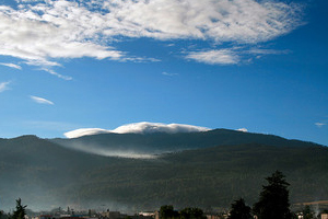
The road to Xico, a small village located 12 miles southeast of Xalapa, offers marvelous views: the landmark hill of San Marcos, with its unique profile of a small volcano, and a seemingly endless panorama of green foliage. The average annual temperature is a pleasant 66º F, and the altitude is 4265 feet above sea level.
Historic Monuments
On a stroll through Xico, a delightful, provincial atmosphere awaits: cobblestone roads, pretty colonial houses with red tile roofs, traditional lamp posts, long colonial windows and an endless variety of small country chapels set in each of the old neighborhoods, whose original traits remain intact. A few suggestions to include on a tour follow.
Pextlan Bridge
Located just two km from Xico, this bridge was built in the 19th century at the point where the river flows through an impressive stone canyon with walls up to 130 feet high carved into the rock by the water. There is also a trout farm. This spot can be reached on foot or by car, taking Nava Street toward Oxtlapa.
The Texolo Waterfall
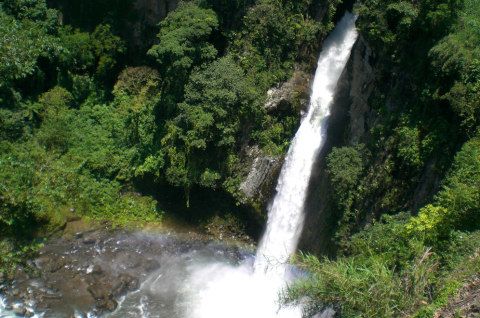
Located about three km from Xico, Texolo and its surrounding continental wetlands are formed by the Matlacòbatl and Texolo rivers. This area contains ecosystems typical of the mountain temperate rain forest, which harbors great biodiversity and is very important due to the environmental benefits that it provides to human settlements, such as water and carbon collection, owing to the very well conserved surrounding forest areas.
A terrace overlooks a 250-feet drop and there is a restaurant, handicraft stores and a parking lot. A steep stairway leads down to the hydroelectric power plant that was constructed at the foot of the waterfall in the late 19th century and still today provides electric energy to the region. The canyon can be crossed via a narrow bridge, which leads to two other waterfalls. Just getting off the bridge is Velo de Novia (Bride’s Veil) Fall, a man-made fall that is said to have been constructed by an engineer as a love-token for his bride in the late 19th century.
Nun´s Waterfall
About 300 yards upriver from Texolo, visitors enjoy swimming in this 40-foot waterfall. Ironically, the waterfall is said to have gotten its name because a nun drowned when swimming in it.
Cofre de Perote Mountain Routes
There are two parallel roads that lead into the foothills of the sentinel mountains Cofre de Perote. The first route, which leads in the direction of Pocitos and runs through the community of Ticuahutipan about 4 miles from Xico, offers a trail that leads to the 50-feet-high La Campana waterfall, the 65-feet-high La Brisa waterfall, the 250-feet-high La Mariposa waterfall, and La Paililla, an impressive rock formation in the middle to the river. Horseback rides are available from Xico to the top.
The upward-leading unpaved road runs through Xico, Viejo t Matlalapa, the highest village in the district. The best view of Teocelo and Xico is from this village. Ecotourists looking to stay in the area enjoy the La Chicharra cabins.
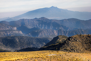
The second route is a scenic highway, a mere 15 miles long, that runs from the south of Xico to the village 4,260 to 8,150 feet above sea level, to the point where the national park begins and from which various footpaths lead to the peak, a journey of four or five hours. Visitors can go on along the unpaved road until reaching the Ayahualulco and Ixhuacan region, or along the longer road leading to the Perote valley.
Just Ánimo…
Travelers seeking memorable ecotravel experiences, including soft adventures, have increasingly chosen Veracruz for the past decade. Resorts including the secluded Agua Bendita Hotel & Spa, located on eight verdant acres with meandering streams, offer posh casitas for travelers seeking a luxurious retreat following an adventurous day. Ánimo and see for yourself.


