From the floatplane, the Bloodvein River appeared as a sparkling ribbon flowing across the countryside. The soft greens of the land and river almost looked pastoral, until the plane splashed down. Then the red-veined granite cliffs and towering stands of poplar and black spruce offered up a harsher backdrop – one that may well have been concealing moose, marten, muskrat or beaver.
If ever there were a middle of nowhere, this would be it. The Bloodvein cuts through a nearly inaccessible section of the Canadian Shield, an ancient rock formation that forms the bedrock of North America and is home to the largest remaining Boreal Upland forest in the world. From its headwaters in Woodland Caribou Provincial Park, 600 km northeast of Thunder Bay, ON, the Bloodvein winds through 340 kilometres of narrow canyons and peaceful marshes before emptying into Lake Winnipeg, about 200 km northeast of Winnipeg.
The Bloodvein was, and is, a traditional working river: A place where Voyageurs made their fortunes trading furs and where modern-day paddlers are still more likely to encounter a Saulteaux-Ojibwa first nation’s fishermen or trapper than a fellow traveller.
First Nations hunter-gathers have lived on the Bloodvein for an estimated 6000 years. And along the river’s banks archaeologists have found village sites containing middens, burial mounds and pottery shards. Pictographs, drawn in red ochre on the river’s canyon walls between 900 and 1,200AD, detail a long-established way of life – where a nomadic people travelled up and down the river hunting, harvesting berries and wild rice, and fishing.
By the time our floatplane had traveled across the rugged landscape from Biscuit Harbour and touched down on a wide, marshy spot on the river – it was obvious we’d entered a landscape that hadn’t really changed since the time of the Voyageur. Our guide, Cameron White explained that this is one of the finest qualities of the river, “There are no roads in. It’s untouched. There’s a few cabins, some fishermen and that’s it.” White explained that this is also what led to the Bloodvein being granted Heritage River designation in 1987.
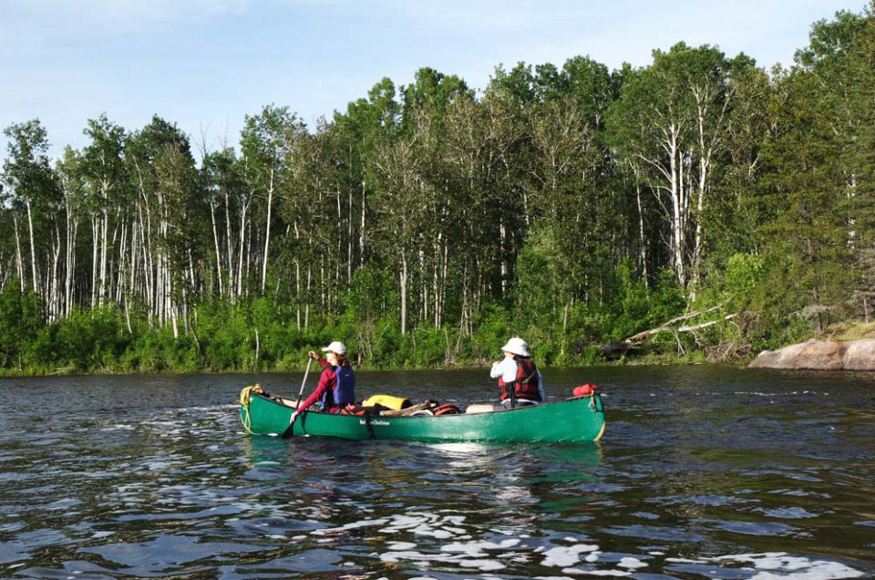
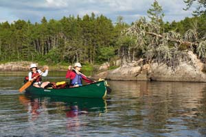
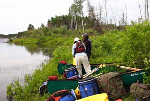
The river’s isolation also means that everything you’ll need has to be flown in (including the canoes) and then packed into large watertight barrels for transport. With our canoes nosed into the reeds we set up them up for travel – barrels in the centre and helmets, bailers, sponges and a spare paddle within easy reach. While we worked, the near fly-sized mosquitoes delivered a toneless buzz that drowned out the distant chatter of white water.
Setting off from shore we caught our first glimpse of the red streaked rock that may have given the river its name. White explained that no one is quite sure where the “Bloodvein” name comes from, but the name first showed up Hudson’s Bay Company journals dated 1818/19. Another source for the name may have come from a bloody battle fought between the Saulteaux, Cree and Ojibwa nations, which was said to have turned the river red.
Because the river has very little loss of elevation over its length there was almost no current in the marshes and lakes (one of the reasons that the river worked so well as a transportation corridor.) Quietly singing old Voyageur songs, White set a gentle pace though the calm water and the first easy swifts – giving us time to practice paddling our boats (for some reason achieving a straight line was eluding my partner and I) and to survey the shoreline.
Eventually though the calm of the Bloodvein gave way to a low rumble. As the sound grew louder, White led us to shore. We beached our loaded canoes and then pushed through the bush to a lookout. Below us, the water boiled and frothed. White explained how to read the river and pointed out the place where our canoes needed to travel to safely make our way through the white water.
We set out again – my paddle shaking and my heartbeat drowning out the roar of the fast-moving water. While I tried to channel a Voyageur for support, my canoe partner, Amy, started to paddle and we executed a perfect, if unplanned, 180. “Special stroke! Do your special stroke!” she yelled over the roar as the stern of our boat shot into the black v-shape that indicated a clear passage. We were already capsized in the surprisingly warm water when I realized “Do your special stroke!” must have meant I needed to pull, not pry.
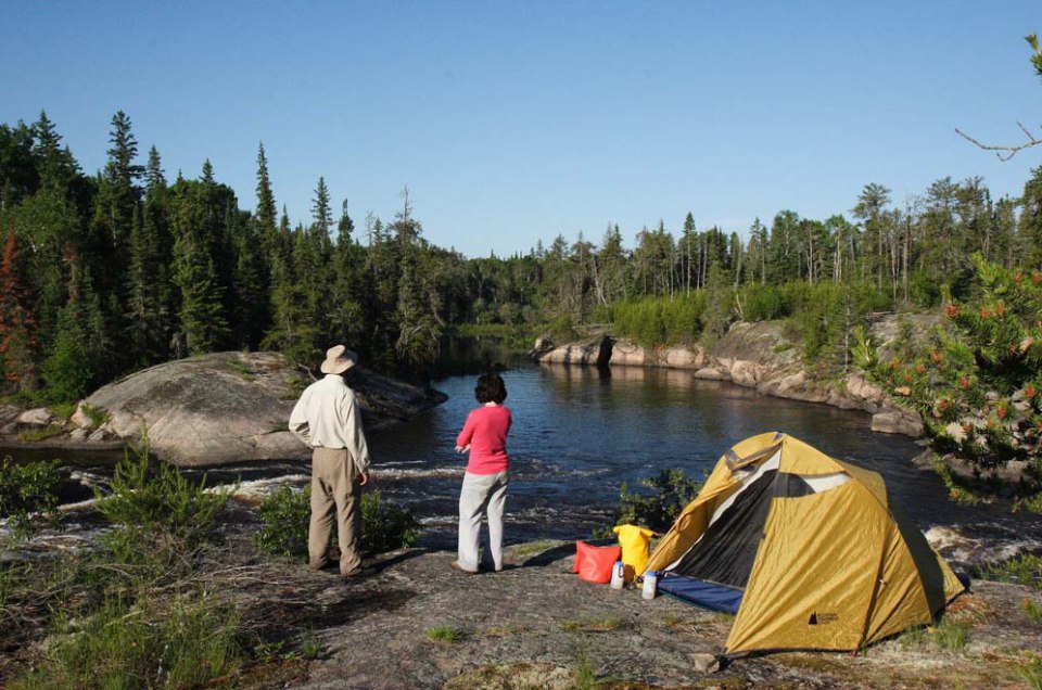
“It’s not a raging Colorado or a peaceful St Lawrence – it’s this ideal mix of quiet lakes and challenging white water,” White explained after we dried ourselves off. We portaged the boats along a path that had probably once seen the feet of first nations people who followed the retreating glaciers north, as well as French and British fur trappers and more recently, adventurous holiday-makers. With our tents set up in a site that has served as a sleeping spot for hundreds of years, Amy headed off to try fishing for ‘walleye’ pickerel and White traded his role as canoe guide for that of gourmet campfire cook.
While they worked to feed us, I went for a careful walk along the river’s edge and tried to sort out just which one of the three-leafed plants I was looking at was poison oak. Then I found a smooth sun-warmed section of rock near the rapids and sat down and closed my eyes. Before planning this trip I had never even heard of the Bloodvein but as river sounds washed over me and a warm breeze blew away the mosquitoes I realized I was sitting in the very centre of a scene I had always imagined: this was the Canada detailed in every history book I’d ever read
It’s still here.
Guiding companies such as Northern Soul offer customized trips on the Bloodvein River. Our trip culminated in a traditional feast and sweat at the Bloodvein First Nations reserve.